
Read the Fine Print
This activity allows students to explore tides and practice answering questions about them.
- Provider:
- National Oceanic and Atmospheric Administration
- Author:
- NOAA
- Date Added:
- 06/24/2019
This activity allows students to explore tides and practice answering questions about them.
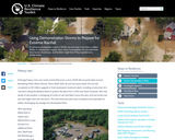
An extreme precipitation event in 2008 cost one town more than a million dollars in infrastructure repairs. Now, other municipalities can simulate how their homes, businesses, and facilities might fare if they experienced a similar event.
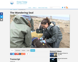
This video shows seals migrating by seasons. This also highlights the decline in their species due to human activity.
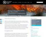
Climate scientists project that future climate conditions will result in increased risk of wildfire across much of the Southwest. Although fires are a natural part of Southern California landscapes, efforts by SDG&E and their partners may help minimize the impacts of future fires.
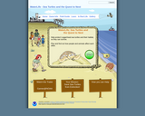
Students find out how people and animals affect each other as they work through the simulation, helping protect Loggerhead sea turtles and their habitat, so they can survive.
This game occurs inside the ecosystem of an estuary on the west coast of the United States. Following a young girl named Valerie, players interact with Oscar the sea otter, and the fictional Claminator, a geoduck clam. To succeed, players must learn about the factors that produce healthy estuaries, food webs, and why estuaries are essential to both ocean life and to humans.
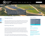
Just south of Atlantas busy Hartsfield-Jackson International Airport, Clayton County seems like an obvious place for metropolitan growth. But more homes and businesses mean a higher demand on the countys limited water supplies.

Property owners in New Jersey can check their vulnerability to sea level rise and storm surge using an interactive mapping toolthe NJ Flood Mapper. Here's how one restaurant owner used results from the tool in his long-term planning.

In this video, a meteorologist talks about the GOES satellite, which monitors solar activity.
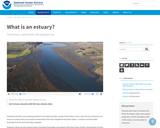
This video from NOAA describes estuaries.

Students explore causes, impacts, and solutions to contaminated runoff. Students will also construct a three-dimensional model of an actual watershed, and use the model to provide information on contaminated runoff to a specific target audience.
Students will access data on selected coral reefs and manipulate these data to characterize these reefs and explain the need for baseline data in coral reef monitoring programs. They will then be able to identify and explain five ways that coral reefs benefit human beings and three major threats to coral reefs.

After most of the city was flattened by a tornado, Joplin, Missouris Mercy Hospital built a new facility, incorporating features to reinforce its resistance to wind.
This link to a booklet provides a comprehensive overview of winter storms, and how to be prepared.

In the wake of Hurricane Sandy, Con Edison examined the future vulnerability of electrical infrastructure. Based on the results, they took action to increase their resilience.
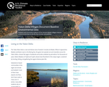
Students and community residents of four remote Alaskan villages measure environmental data to identify their climate vulnerabilities.