
This activity allows students to track hurricane data using coordinates.
- Subject:
- Earth Science
- Science
- Material Type:
- Activity/Lab
- Provider:
- National Oceanic and Atmospheric Administration
- Author:
- NOAA
- Date Added:
- 02/26/2019

This activity allows students to track hurricane data using coordinates.
This article highlights oyster management best practices in the Gulf of Mexico.

This resource explains the causes and effects of major oil spills and the role that ocean currents play in the spread of pollution.
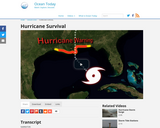
This short video discusses how to be prepared in the event of a hurricane.
Students will use maps and online data resources to locate the specific geographic areas included in aerial photographs. They will also use aerial photographic imagery to assess some impacts of Hurricane Katrina.

Students will form models of various underwater landform features and create and interpret bathymetric and topographic maps. This curriculum guide outlines three lesson plans that deal with exploration and mapping of the ocean floor.

This video highlights the impact that rising sea levels has on estuaries.

This interactive shows the position of the sun, relative to Earth, as it moves through space.
This interactive helps students understand the role of biodiversity in different regions of the U.S., and how invasive species impact native populations.
This video shows how Hawaiians use Reduce, Reuse, Recycle, to convert abandoned sea nets to energy.

This article highlights oyster management best practices in the Gulf of Mexico.

This series of lessons focuses on unique geologic ocean features, their formation, function, locations, characteristics, and origins. Students will describe the motion of tectonic plates and differentiate between three typical boundary types between tectonic plates and infer the type of boundary that exists between two plates, based on the occurrence of earthquakes and volcanoes in the vicinity. In Lesson Plan 9, "The Galapagos Spreading Center," students will model sea floor spreading, using the Galapagos Spreading Center as an example. In Lesson Plan 10, "AdVENTurous Findings on the Deep-Sea Floor," students will create a model hydrothermal vent. In Lesson Plan 11, "Volcanoes, Plates, Seamounts, and Island Chains," students will describe the processes that form seamount and island chains and relate tectonic plate movement and type of volcanic activity associated with these movements. In Lesson Plan 12, "Islands, Reefs and Hotspots," students will map and describe the stages of Hawaiian Island formations.

This series of lessons focuses on food production in ocean ecosystems. In Lesson Plan 15, "Being Productive in the Arctic Ocean," students will investigate how organisms make food, either through photosynthesis or chemosynthesis. They will also identify factors that limit primary productivity and explain their effects. In Lesson Plan 16, "Chemosynthesis for the Classroom," students will observe the development of chemosynthetic bacterial communities in black mud and explain the relevance of chemosynthesis to biological cold-seep communities. In Lesson Plan 17, "Biochemical Detectives,' students will explore the energy-obtaining strategies of cold-seep organisms and study actual data from biochemical studies involving these organisms. Students will write brief essays summarizing each lesson as assessment.
This video shows how quickly oil spills can be carried by currents.
This video highlights the life cycle of salmon. As they swim upstream, they are impacted by predators and hydropower.
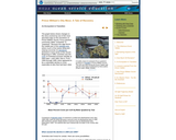
This comprehensive online resource discusses how an ecosystem is affected and begins recovery from an major oil spill. The Exxon Valdez oil spill in Alaska's Prince William Sound is highlighted as an example.

This interactive resource allows students to see Carbon Dioxide with real time data.
This 4 minute video describes the problems fish face when dams are built, then highlights what needs to be done to restore their habitat.
This video shows sea ice, and explains the reasons why it's melting.
This video shows the instruments and data used to measure sea levels and discusses local and global impacts of sea level rise.