
In this lesson, students work collaboratively and use art supplies to create a display of the Earth's landforms.
- Subject:
- Science
- Material Type:
- Activity/Lab
- Provider:
- Crayola
- Date Added:
- 06/14/2018

In this lesson, students work collaboratively and use art supplies to create a display of the Earth's landforms.
In this activity, students learn about different types of water erosion and develop strategies to slow down erosion where man is involved.
In this activity, students learn about different types of wind and ice erosion and explain the difference between weathering and erosion.
In this lesson, students experiment with representative materials to understand crustal interactions. By the end of the lesson, students will be able to list and draw the three types of plate interactions and name one landform that results from each plate interaction.
In this lesson, students explore how convection currents cause crustal plate movement.
In this lesson, students demonstrate how different valleys are formed by flowing water or ice. Students list the erosional processes that form valleys and identify the landform in photos or in nature.
In this lesson, students create pie-shaped landforms and understand how and where they form. Students will distinguish between alluvial fans and deltas by their depositional environments.
In this lesson, students use blocks of wood to distinguish among fault types and describe the movement along each type.
In this lesson, students investigate how plants perform a vital part in the hydrologic cycle.
In this lesson, students use slinkies to imitate and better understand the two types of waves assocaited with earthquakes.
In this activity, students will see the relative sizes of the planets and how far apart they really are. This activity will especially emphasize how large and empty of a place our solar system really is.
In this activity, students explore cloud formation and precipitation by observing and recording weather data, as well as setting up a "cloud chamber" to observe evaporated water vapor as it condenses and precipitates.
In this activity, students will investigate the history of magnets and explore some of the ways that we use magnets.
In this activity, students observe how rock properties change from rock type to rock type due to different processes. Students will diagram the rock cycle and label the stresses that cause change between each rock type.
In this activity, students demonstrate how water flows on the surface as part of the hydrologic cycle. Students will observe how water gathers in channels and learn how to measure watersheds in terms of magnitude.
In this activity, students use sponges and sand to show how groundwater fits into the water cycle.
In this lesson, students experiment with how tectonic forces form mountains. Students will recreate each landform made by drawing it on paper or using foam strips to model. After performing the force needed to create different landforms, students will label on paper the direction of the movement of the rock corresponding to each force.
In this activity, students are introduced to water and its three phases - solid, liquid, vapor. Students will use their senses to observe, taste, feel, and describe water, and their imaginations to understand the concepts of water's phases.
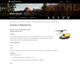
In this lesson, students will construct a house in the same way ancient pueblo people did using resources according to their availability and specific properties. Students will understand the importance of knowing rock and mineral properties in order to determine usefulness.

In this activity, students remove measured amounts of water from a 5-gallon bucket, simulating the amount of fresh water available on earth.