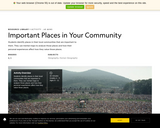
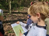
Students identify places in their local communities that are important to them. …
Students identify places in their local communities that are important to them. They use mental maps to analyze those places and how their personal experiences affect how they value those places.
Students will investigate patterns in immigration through data tables and data maps. …
Students will investigate patterns in immigration through data tables and data maps. They can also develop their own graphs to view the information in other ways.
This video series is broken up into two-part mini programs which each …
This video series is broken up into two-part mini programs which each include a short video history lesson followed by a second video with a craft activity. These videos are designed to be viewed together to learn about history of Vance Birthplace State Historic Site in the mountains of North Carolina and life in the 1800s.
Children and adults can enjoy exploring lighthouses and the maritime history of …
Children and adults can enjoy exploring lighthouses and the maritime history of the United States together through children's literature, everyday objects, and hands-on activities
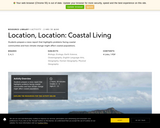
In this lesson, student groups research an established coastal community. After locating …
In this lesson, student groups research an established coastal community. After locating it on a map, they will find out about its geography, cultural climate, and typical architecture. Students will make a detailed drawing of the coastal community and write a paragraph to accompany their artwork.
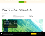
Students label major rivers and outline watersheds on a world map. They …
Students label major rivers and outline watersheds on a world map. They compare the shapes of various watersheds and discuss how topography influences their shapes.
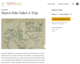
Students will learn about the remarkable travels of Marco Polo. They will …
Students will learn about the remarkable travels of Marco Polo. They will consult maps to locate Venice and follow the routes Marco took to Beijing and back. They will learn about the challenges of traveling along the Silk Road, discover some interesting facts about China under Mongol rule, and find out how Marco came to produce his famous book.
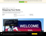
What do you think makes Michigan special? You might be thinking that …
What do you think makes Michigan special? You might be thinking that Michigan is special because it is your home. Maybe it is special because the people you care about live in Michigan. These are wonderful reasons. This resource will help you learn about many other ways that Michigan is special.
The NC Kids' Exploration Journals are a fun educational tool to help …
The NC Kids' Exploration Journals are a fun educational tool to help youth explore their communities and natural surroundings! Each journal contains: 18 multidisciplinary activities with guided prompts, 6 lined journal pages for recording observations and reflections, and 4 blank pages for individual creativity.
The digital versions of the journal are designed to be printed out for students either as individual activities or in its entirety so that they can explore their school yard, local park, or own backyard. Though designed for 1st - 5th-graders, older audiences may enjoy them too! They are also available in both English and Spanish languages.
While supplies last, hard copies of the journals are currently available for free to teachers by contacting karen.ipock@ncdcr.gov.
Students explore the characteristics of the physical environment of communities, including their …
Students explore the characteristics of the physical environment of communities, including their own community, in order to describe and explain variations in the physical environment, including climate, landforms, natural resources, and natural hazards. They also explore these characteristics to identify and compare how people in different communities adapt to the physical environment in which they live. They also look at the journals of Christopher Columbus.
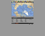
This interactive map of North America contains links to country maps which …
This interactive map of North America contains links to country maps which provide information such as, population, flag, language, capital, industry, and agriculture.
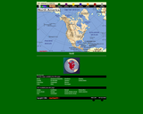
This interactive map of the North Pole contains links to country maps …
This interactive map of the North Pole contains links to country maps which provide information such as, population, flag, language, capital, industry, and agriculture.
In this resource, students can learn about the geography of the United …
In this resource, students can learn about the geography of the United States through short videos, mini-activities, and practice questions. The eight questions in this segment cover topics such as, the longest rivers in the country, the oceans that border the country, and the states that border Canada and Mexico. This site was designed with the needs of recent immigrants in mind. It is written at a “low-intermediate†ESL level.
This Teacher Guide identifies the Civics Test questions covered in the theme, …
This Teacher Guide identifies the Civics Test questions covered in the theme, Geography. It also provides the instructional steps to familiarize teachers with the elements and navigation of the Preparing for the Oath - Geography student interactive so that they can be comfortable presenting it to their class.
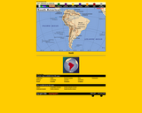
This interactive map of South America contains links to country maps which …
This interactive map of South America contains links to country maps which provide information such as, population, flag, language, capital, industry, and agriculture.
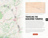
In this activity, students use a story map to follow the historic …
In this activity, students use a story map to follow the historic route of the Buncombe Turnpike and learn more about its economic and cultural impact on western North Carolina. Students will also see how the landscape has transformed in the nearly 200 years since the creation of the Turnpike.
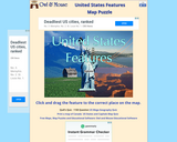
This interactive will allow students to become familiar with the rivers and …
This interactive will allow students to become familiar with the rivers and mountains of the United States. Students will drag and position the features to the correct location on the map.
Higher-level students will work collaboratively to create trivia game cards about the …
Higher-level students will work collaboratively to create trivia game cards about the elements that define states and nations. They will find information on the internet or in books to help them find information about specific states and nations. Students will analyze the information to determine which information would be important enough to include on the game card to help someone figure out the answer. The information that they will be finding will include details about culture, demographics, economy, and geography of the state or nation for which they are trying to define and write a trivia card. This lesson was developed by NCDPI as part of the Academically and/or Intellectually Gifted Instructional Resources Project. This lesson plan has been vetted at the state level for standards alignment, AIG focus, and content accuracy.
No restrictions on your remixing, redistributing, or making derivative works. Give credit to the author, as required.
Your remixing, redistributing, or making derivatives works comes with some restrictions, including how it is shared.
Your redistributing comes with some restrictions. Do not remix or make derivative works.
Most restrictive license type. Prohibits most uses, sharing, and any changes.
Copyrighted materials, available under Fair Use and the TEACH Act for US-based educators, or other custom arrangements. Go to the resource provider to see their individual restrictions.