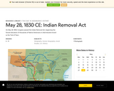
This map and article detail the routes of the five southeastern tribes …
This map and article detail the routes of the five southeastern tribes that were forced to leave their homelands in the Southeast and live in Indian Territory in what is now Oklahoma.
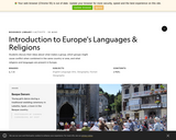
Students discuss their ideas about what makes a group, which groups might …
Students discuss their ideas about what makes a group, which groups might cause conflict when combined in the same country or area, and what religions and languages are present in Europe.
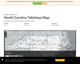
The NC map includes state boundaries, interstate highways, rivers, and the top …
The NC map includes state boundaries, interstate highways, rivers, and the top ten most populous cities in the state. The map is available as a downloadable tiled PDF that can be printed, laminated, and assembled to engage students in group work to learn about their state's geography. The tiled map is a large map that prints out on several 8.5'' by 11'' sheets of paper for easy assembly and convenient printing. The map is also available as a "poster version" that can be printed on a large-format printer.
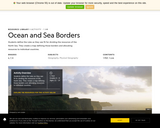
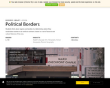
Students define the rules as they see fit for dividing the resources …
Students define the rules as they see fit for dividing the resources of the North Sea and create a map defining those borders and allocating resources to individual countries.
Students think about regions and borders by determining where they would place …
Students think about regions and borders by determining where they would place borders in an artificial continent, based on a set of physical and cultural features of the area.
This unit, from the Watershed Dynamics curriculum, uses National Geographic FieldScope as …
This unit, from the Watershed Dynamics curriculum, uses National Geographic FieldScope as a key tool for investigating water availability. The unit is designed to teach students about water availability and the impacts of human activity on the watersheds we live in. Students and teachers learn to use geographic information system (GIS) tools and various data sets to answer questions about the environment.
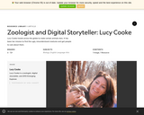
Lucy Cooke travels across the globe to make certain animals stars. It …
Lucy Cooke travels across the globe to make certain animals stars. It has been her mission to find the ugly, misunderstood creatures and get people to care about them. This is just an article--no lesson ideas included. It would be great for Informational text standards.
No restrictions on your remixing, redistributing, or making derivative works. Give credit to the author, as required.
Your remixing, redistributing, or making derivatives works comes with some restrictions, including how it is shared.
Your redistributing comes with some restrictions. Do not remix or make derivative works.
Most restrictive license type. Prohibits most uses, sharing, and any changes.
Copyrighted materials, available under Fair Use and the TEACH Act for US-based educators, or other custom arrangements. Go to the resource provider to see their individual restrictions.