Students will investigate how climate affects soil and its formation. The inquiry …
Students will investigate how climate affects soil and its formation. The inquiry activity will demonstrate how soil temperature is affected by water content, plant or mulch cover, and aspect.
Students will use a GIS map to compare the Rocky Mountains and …
Students will use a GIS map to compare the Rocky Mountains and the Andes Mountains. They will also investigate the relationship between mountain ranges and plate boundaries.
Students will construct two wetlands models, one with constant drainage and one …
Students will construct two wetlands models, one with constant drainage and one that maintains a well-saturated soil. Students will maintain the wetlands for two weeks and observe daily the soil, plant life, water level, and animal life if desired.
This interactive mapping activity will help students understand the relationship between the …
This interactive mapping activity will help students understand the relationship between the population of a given state and the amount of energy consumed there.
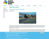
Students wil use Geographic Information Systems (GIS) to investigate earthquakes, volcanoes, and …
Students wil use Geographic Information Systems (GIS) to investigate earthquakes, volcanoes, and population from a local to global scale. The lessons can be used with other data in the Global GIS project to investigate earthquakes in other continents.
Students will investigate how different soils have different capacities for retaining rainwater. …
Students will investigate how different soils have different capacities for retaining rainwater. They will also explain how and why a river can flood in a particular area.
No restrictions on your remixing, redistributing, or making derivative works. Give credit to the author, as required.
Your remixing, redistributing, or making derivatives works comes with some restrictions, including how it is shared.
Your redistributing comes with some restrictions. Do not remix or make derivative works.
Most restrictive license type. Prohibits most uses, sharing, and any changes.
Copyrighted materials, available under Fair Use and the TEACH Act for US-based educators, or other custom arrangements. Go to the resource provider to see their individual restrictions.