In this lesson, students use scale drawings to solve real world problems involving perimeter and area.
- Subject:
- Mathematics
- Material Type:
- Lesson Plan
- Provider:
- Beacon Learning Center
- Date Added:
- 03/22/2017

In this lesson, students use scale drawings to solve real world problems involving perimeter and area.
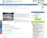
Students construct model landfill liners using tape and strips of plastic, within resource constraints. The challenge is to construct a bag that is able to hold a cup of water without leaking. This represents similar challenges that environmental engineers face when piecing together liners for real landfills that are acres and acres in size.

After reading the novel, “The Outsiders”, by S.E. Hinton, students will follow the engineering design process to build fire truck vehicles that will transport water from a starting line, 20 feet, to a finish line to put the “fire” out. The students' fire trucks will be powered by a Sphero robot and driven using the Sphero app. Students will work in groups of 3-4. Students will be supplied with a 3 oz cup to represent a fire bucket and a 16 oz cup to represent the fire. The cup that represents fire will have a high water mark drawn on it and students must fill their cup to the mark to successfully complete the challenge.
The purpose of this task is for students to translate between measurements given in a scale drawing and the corresponding measurements of the object represented by the scale drawing.
Students sketch a map of their classroom, make a scale drawing from the sketch, and draft a computer-aided design floor plan from the drawing.
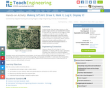
Students design their own logo or picture and use a handheld GPS receiver to map it out. They write out a word or graphic on a field or playground, walk the path, and log GPS data. The results display their "art" on their GPS receiver screen.

Students will build upon reasoning of ratios and rates to formally define proportional relationships and the constant of proportionality. They explore multiple representations of proportional relationships by looking at tables, graphs, equations, and verbal descriptions, extend their understanding about ratios and proportional relationships to compute unit rates for ratios and rates specified by rational numbers.
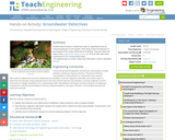
Student teams locate a contaminant spill in a hypothetical site by measuring the pH of soil samples. Then they predict the direction of groundwater flow using mathematical modeling. They also use the engineering design process to come up with alternative treatments for the contaminated water.
In this lesson, students discover a number pattern and write an equation that describes it.

This lesson will allow students to become familiar with the concept of equivalent ratios and similar objects. Through an open investigation students will develop methods to find equivalent ratios. This is a lesson to be used as part of a unit with Painter Problems and How Far Can You Leap found in ALEX.
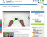
Students capture and examine air particles to gain an appreciation of how much dust, pollen and other particulate matter is present in the air around them. Students place "pollution detectors" at various locations to determine which places have a lot of particles in the air and which places do not have as many. Quantifying and describing these particles is a first step towards engineering methods of removing contaminants from the air.
Students use scaling from real-world data to obtain an idea of the immense size of Mars in relation to the Earth and the Moon, as well as the distances between them. Students calculate dimensions of the scaled versions of the planets, and then use balloons to represent their relative sizes and locations.
Acting as if they are biomedical engineers, students design and print 3D prototypes of pressure sensors that measure the pressure of the eyes of people diagnosed with glaucoma. After completing the tasks within the associated lesson, students conduct research on pressure gauges, apply their understanding of radio-frequency identification (RFID) technology and its components, iterate their designs to make improvements, and use 3D software to design and print 3D prototypes. After successful 3D printing, teams present their models to their peers. If a 3D printer is not available, use alternate fabrication materials such as modeling clay, or end the activity once the designs are complete.
Spatial visualization is the study of two- and three-dimensional objects and the practice of mental manipulation of objects. Spatial visualization skills are important in a range of subjects and activities like mathematics, physics, engineering, art and sports! In this lesson, students are introduced to the concept of spatial visualization and measure their spatial visualization skills by taking the provided 12-question quiz. Following the lesson, students complete the four associated spatial visualization activities and then re-take the quiz to see how much their spatial visualization skills have improved.
In this activity, students design an innovative human shelter that is inspired and informed by an animal structure. Each group is assigned an animal class, and they gather information about shelters used by the animals in that class. After researching the topic and brainstorming ideas, students build small prototypes (models) of the structures. Finally, they present their products, explaining what attribute of the animal structure influenced their design.

In this comics-style video, students are introduced to the villian, Scaleo who has escaped from prison and is transforming length, width, and height of objects until they become usless...or dangerous. Super heroine, Scale Ella uses the power of scale factor to foil the villan.
In this activity, students explore the importance of charts to navigation on bodies of water. Using one worksheet, students learn to read the major map features found on a real nautical chart. Using another worksheet, students draw their own nautical chart using the symbols and identifying information learned.
Students learn about two-axis rotations, and specifically how to rotate objects both physically and mentally about two axes. A two-axis rotation is a rotation of an object about a combination of x, y or z-axes, as opposed to a single-axis rotation, which is about a single x, y or z-axis. Students practice drawing two-axis rotations through an exercise using simple cube blocks to create shapes, and then drawing on triangle-dot paper the shapes from various x-, y- and z-axis rotation perspectives. They use the right-hand rule to explore the rotations of objects. A worksheet is provided. This activity is part of a multi-activity series towards improving spatial visualization skills. At activity end, students re-take the 12-question quiz they took in the associated lesson (before conducting four associated activities) to measure how their spatial visualizations skills improved.
Normally we find things using landmark navigation. When you move to a new place, it may take you awhile to explore the new streets and buildings, but eventually you recognize enough landmarks and remember where they are in relation to each other. However, another accurate method for locating places and things is using grids and coordinates. In this activity, students will come up with their own system of a grid and coordinates for their classroom and understand why it is important to have one common method of map-making.
Celestial navigation is the art and science of finding one's geographic position by means of astronomical observations, particularly by measuring altitudes of celestial objects sun, moon, planets or stars. This activity starts with a basic, but very important and useful, celestial measurement: measuring the altitude of Polaris (the North Star) or measuring the latitude.