An engaging lesson using Dash robot to help students identify and describe different attributes of landforms.
- Subject:
- Applied Science
- Computer Science
- Social Studies
- Material Type:
- Activity/Lab
- Date Added:
- 03/17/2023

An engaging lesson using Dash robot to help students identify and describe different attributes of landforms.
In this lesson, students work collaboratively and use art supplies to create a display of the Earth's landforms.

In this activity, students learn how islands are formed and then build models of different kinds of islands to illustrate learning.

In this lesson students will learn about six of Earth's land features and create a tour of examples using Google Tour Builder.

This is a 36 slide powerpoint presentation providing information about landforms with vivid illustrations, geographic terms, and definitions provided.
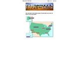
This resource supports English language development for English language learners. In this interactive activity, students learn the vocabulary of different land forms in different regions of the United States. They click on the word and a picture and brief explanation appears.
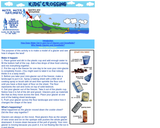
Students will make a model glacier and observe how glaciers shape the land.

Using word association and early maps of North Carolina, students will examine their preconceptions about the state and connect them to what they learn. This assignment acts as a diagnostic assessment. The benefit of using colonial maps rather than a current map of North Carolina is that students can make a connection between discovery and progression in the creation of the state that they know. This is intended to be used before any lesson about colonial times or discovery of America in general?the students can consider themselves ?explorers? along with the ones they learn about.