As a society, we use land in many different ways. The way …
As a society, we use land in many different ways. The way we use land has a tremendous impact on how water flows over and through land as it makes it way to streams, rivers, and the Great Lakes. When rainwater falls on land, it gradually makes its way downhill. In developed areas, including both farms and urban areas, there is much less vegetation to slow the water down. As a result, the water moves quickly over the surface of the ground, picking up dirt and other materials and carrying it along with the flow of water. This process is known as "erosion." The suspended material, called "sediment," is carried through the watershed to the streams, rivers, and lakes. Success with this lesson will happen when students are able to explore the land use around sample Michigan sites, and use that information to analyze which sites have the highest average sediment levels and which have the lowest.
Rivers are incredibly important to our society and our environment, but we …
Rivers are incredibly important to our society and our environment, but we haven't always treated our rivers as well as we should. By using pictures taken from satellites orbiting the earth, we can examine rivers all over Michigan and try to identify those rivers that appear to have higher water quality and those that appear to have lower quality. Based on the illustrations provided, students will be able to make a number of observations about the quality of Michigan's rivers. Two specific rivers, the Rouge River and Escanaba River, will be observed and conclusions made about water quality and types of land use surrounding it. Lesson success will include having students log into ArcGIS Online to explore the river nearest their home so they can produce a table of observations and a 3-5 sentence paragraph to summarize their findings.
There are many different ways to precisely measure the quality of water …
There are many different ways to precisely measure the quality of water in a river. Environmental scientists and volunteers all over the state of Michigan are continuously collecting measurements of the quality of water in rivers, streams, and lakes. Students will look at two of these measures to see how they change with location around the state and along a river. The first measure of water quality is called "water conductance" - that is, how well a water sample can conduct electricity. A higher water conductance generally means lower water quality. The second measure of water quality is "pH." pH is a measure of how acidic or basic water is. Successful students will be able to interpret and analyze data using these two measures to better understand Michigan water quality.
As rain falls all over Michigan, the water gathers in small local …
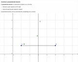
As rain falls all over Michigan, the water gathers in small local watersheds, which feed into larger regional watersheds, which ultimately feed into the Great Lakes. Water that falls on the land in Michigan eventually flows into one of the Great Lakes because the elevation of the Great Lakes is generally lower than the elevation of the land in Michigan. Students will be able to use elevation maps to study water flow from watersheds emptying into the Great Lakes. Success with this lesson will happen when students can investigate the Great Lakes water flow and produce a simple diagram that illustrates this flow pattern.
This activity focuses on the different types of land use found in …
This activity focuses on the different types of land use found in rural landscapes.
GeoInquiries are designed to be fast and easy-to-use instructional resources that incorporate advanced web mapping technology. Each 15-minute activity in a collection is intended to be presented by the instructor from a single computer/projector classroom arrangement. No installation, fees, or logins are necessary to use these materials and software.
Students will be involved in a group research of "How to" books …
Students will be involved in a group research of "How to" books and videos. Then, they will create their own "How to" writing using See Saw as their on-line creation "house". Students will work in collaborative groups during the entire process and learn how to complete the task as a team. Students will be given daily feedback from their teacher as well as final peer and teacher feedback.
This unit will be designed to be taught concurrently with other units …
This unit will be designed to be taught concurrently with other units throughout the beginning (1st quarter and beginning of 2nd quarter) of the school year. It will focus on teaching grammar concepts in context. Front-loading grammar instruction has been a focus of the district ELA department.
Students choose and research a state using online search sites, and then …
Students choose and research a state using online search sites, and then using an online template, log their research. Research includes the geography, economy, and history of the state, in addition to other facts such as interesting places to visit and a comparison of their chosen state to their home state of Michigan. Students write a draft of their report, a final typed version of their report, and then create a google slide presentation using Slide Deck about their state. Students will also draw a detailed map of their state showing a variety of geographical features (to be inserted in their presentation).
In this unit, students build on fraction concepts from previous grades to …
In this unit, students build on fraction concepts from previous grades to understand fractions as division. They also use visual models to make estimates, add and subtract fractions and mixed numbers, and check the reasonableness of their answers. Finally, students explore strategies for solving fraction-of problems.
As the United States acquired land and new states formed, the balance …
As the United States acquired land and new states formed, the balance of power between the free and slave states needed to be addressed.
GeoInquiries are designed to be fast and easy-to-use instructional resources that incorporate advanced web mapping technology. Each 15-minute activity in a collection is intended to be presented by the instructor from a single computer/projector classroom arrangement. No installation, fees, or logins are necessary to use these materials and software.
This unit builds on the student's prior learning of how to find …
This unit builds on the student's prior learning of how to find a rule that takes a given input value to exactly one output value. In this unit students will be able to identify when a relation is a function and use proper vocabulary (domain and range) and function notation.
Families of functions will be introduced in this unit including linear, absolute value, exponential and quadratic families of functions. Students will use graphs, tables and equations to identify the parent function and be able make a graph from the information in an equation and vice versa. This unit also introduces students to the concept of functions and their inverses. Students will write expressions for simple, linear functions that have an inverse.
Students will continue to use the concepts learned in this unit throughout the remainder of the course and in high school courses.
Students will understand that applying the various Elements of Geography helps us …
Students will understand that applying the various Elements of Geography helps us to understand our past. By exploring the World in Spatial Terms, Places and Regions, Physical Systems, Human Systems, and Environment and Society, we can use Geography to comprehend the issues of history, identify where events took place, what those places were like, how the places changed over time, and how people thought of the world at different times.
No restrictions on your remixing, redistributing, or making derivative works. Give credit to the author, as required.
Your remixing, redistributing, or making derivatives works comes with some restrictions, including how it is shared.
Your redistributing comes with some restrictions. Do not remix or make derivative works.
Most restrictive license type. Prohibits most uses, sharing, and any changes.
Copyrighted materials, available under Fair Use and the TEACH Act for US-based educators, or other custom arrangements. Go to the resource provider to see their individual restrictions.