This parent guide supports parents in helping their child at home with …
This parent guide supports parents in helping their child at home with the 3rd grade Social Studies content. Within the folder you will access Parent Guide PDFs in FIVE Languages: Arabic, English, Hindi, Spanish, and Vietnamese to help on-going communication with caregivers.
This resource accompanies our Rethink 3rd Grade Science course. It includes ideas …
This resource accompanies our Rethink 3rd Grade Science course. It includes ideas for use, ways to support exceptional children, ways to extend learning, digital resources and tools, tips for supporting English Language Learners and students with visual and hearing impairments. There are also ideas for offline learning.
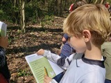
Students make observations and gather information over several days or sessions. Then …
Students make observations and gather information over several days or sessions. Then they summarize reasons why public services are located where they are.
Students will illustrate how the use, conservation or depletion of natural resources …
Students will illustrate how the use, conservation or depletion of natural resources affects an area. They will also show how people "return to nature" hoping to find inspiration that will help them cope with the stresses of their everyday lives.
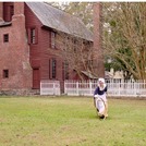
This virtual field trip from Historic Bath State Site is a fun …
This virtual field trip from Historic Bath State Site is a fun way to learn more about a kid's life in the 18th century. The field trip packet contains ,links to YouTube videos of costumed interpreters demonstrating historic activities, pre- and post-watch content for educators that provide context and engagement, and follow-up activities (games, crafts, and coloring pages). Live Q&A can be booked as part of the field trip as well.
Fort Dobbs has created a series of short videos designed to teach …
Fort Dobbs has created a series of short videos designed to teach students about the settlement of the Northwest Carolina backcountry, the lives of the Native Americans living in and near the region of Fort Dobbs, the life of a North Carolina Provincial Soldier, and North Carolina's role during the French and Indian War. The videos are designed for teachers to use them separately to fit into their own lessons or can be grouped together by theme.
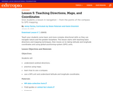
This lesson will address the physical and human characteristics of the local …
This lesson will address the physical and human characteristics of the local community. Students will build geographic vocabulary as well as use map skills.
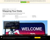
In this lesson, students practice using map elements to study location, distance, …
In this lesson, students practice using map elements to study location, distance, and directions and create maps of the local community, comparing differences in human characteristics in rural and urban communities.
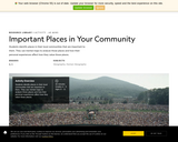
Students identify places in their local communities that are important to them. …
Students identify places in their local communities that are important to them. They use mental maps to analyze those places and how their personal experiences affect how they value those places.
Students will investigate patterns in immigration through data tables and data maps. …
Students will investigate patterns in immigration through data tables and data maps. They can also develop their own graphs to view the information in other ways.
In this lesson, students practice their relative location skills. They will create …
In this lesson, students practice their relative location skills. They will create an illustrated neighborhood map showing landmarks they pass on a specific journey through their neighborhood. They will also write a story about a journey someone might take using the map as a visual aid.
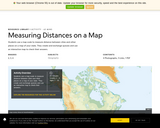
Students use a map scale to measure the distance between cities and …
Students use a map scale to measure the distance between cities and other places on a map of your state. They will create and exchange quizzes and use an interactive map to check their answers.
Students practice using map elements to study location, distance, and directions and …
Students practice using map elements to study location, distance, and directions and create maps of the local community, comparing differences in human characteristics in rural and urban communities.
The NC Kids' Exploration Journals are a fun educational tool to help …
The NC Kids' Exploration Journals are a fun educational tool to help youth explore their communities and natural surroundings! Each journal contains: 18 multidisciplinary activities with guided prompts, 6 lined journal pages for recording observations and reflections, and 4 blank pages for individual creativity.
The digital versions of the journal are designed to be printed out for students either as individual activities or in its entirety so that they can explore their school yard, local park, or own backyard. Though designed for 1st - 5th-graders, older audiences may enjoy them too! They are also available in both English and Spanish languages.
While supplies last, hard copies of the journals are currently available for free to teachers by contacting karen.ipock@ncdcr.gov.
No restrictions on your remixing, redistributing, or making derivative works. Give credit to the author, as required.
Your remixing, redistributing, or making derivatives works comes with some restrictions, including how it is shared.
Your redistributing comes with some restrictions. Do not remix or make derivative works.
Most restrictive license type. Prohibits most uses, sharing, and any changes.
Copyrighted materials, available under Fair Use and the TEACH Act for US-based educators, or other custom arrangements. Go to the resource provider to see their individual restrictions.