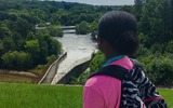
Students locate the Mayan Riviera on a map, watch a demonstration to …
Students locate the Mayan Riviera on a map, watch a demonstration to understand the concept of groundwater held in underground rivers and aquifers, and discuss pollution in the area.
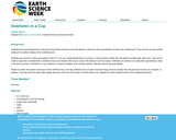
In this virtual resource, students will model the function of a watershed, …
In this virtual resource, students will model the function of a watershed, and apply these concepts to an investigation of how water flows on their school grounds.
The wakelet site features videos demonstrating hands-on activities for students to complete at school in small, socially-distanced settings. Activities may also be adapted for at-home learning. Some activities incorporate an outdoor component, acknowledging the need to balance screen time with green time to support mental health. Tips for taking your students outside can be found here: https://education.eol.org/cnc_materials/TipsForTeachingOutside.pdf
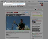
In the PBS NewsHour Student Reporting Lab video, "Colonia residents demand clean, …
In the PBS NewsHour Student Reporting Lab video, "Colonia residents demand clean, safe water," Las Cruces High School students describe climate changes and human activities which impact quality and availability of groundwater, a natural resource of drinking and household water for over 1.5 million Americans. Students gather information from a low-cost physical model and from USGS (United States Geological Survey) and EPA (Environmenal Protection Agency) internet resources. Students then choose a part of the groundwater and well problem, propose a solution and defend their proposal.
In this activity, students will examine the three main factors that disrupt …
In this activity, students will examine the three main factors that disrupt corals. Students will use a Geographic Information System (GIS) tool to evaluate threats on coral reefs, explain how certain fishing practices, pollution, and climate change can damage coral ecosystems, and describe the predicted consequences for coral reefs.
This lesson uses Landsat imagery to introduce students to remote sensing as …
This lesson uses Landsat imagery to introduce students to remote sensing as a tool that is used by water resource managers to understand land use and hydrologic changes. Students will investigate the water budget for Falls Lake, NC from 2007-2009 by analyzing satellite imagery and hydrologic data from the US Army Corp of Engineers and will learn about the interrelationship between hydrologic and human systems.
This chapter studies the relationship between precipitation, evaporation, and surface runoff data, …
This chapter studies the relationship between precipitation, evaporation, and surface runoff data, collected and aggregated by the North American Regional Reanalysis project. Using FieldScope, an online GIS created at the National Geographic Society, you will explore data layers, create a map table for comparison, and analyze geographic patterns.
This notebook provides five lesson plans developed to help educators discuss the …
This notebook provides five lesson plans developed to help educators discuss the subject of ground water with students in grades 6-8. Topics include: aquifers, porosity, permeability, and wells.
In this lab, students will analyze data and interpret graphs and charts …
In this lab, students will analyze data and interpret graphs and charts that show the distribution of the world's water. Students will develop a sense of where the world's water is, as well as where it's going.
In this lab, students will analyze data and interpret graphs and charts …
In this lab, students will analyze data and interpret graphs and charts that show the distribution of the world's water. Students will develop a sense of where the world's water is, as well as where it's going.
Part A of this lab talks about where Earth's water is, but …
Part A of this lab talks about where Earth's water is, but not about where it's going. Interactions between the sun's energy and Earth's gravity keep water moving through the water cycle at all times.
In this activity students will learn about the available water in the …
In this activity students will learn about the available water in the world. Students will look at projections of the amount of freshwater available in the future.
No restrictions on your remixing, redistributing, or making derivative works. Give credit to the author, as required.
Your remixing, redistributing, or making derivatives works comes with some restrictions, including how it is shared.
Your redistributing comes with some restrictions. Do not remix or make derivative works.
Most restrictive license type. Prohibits most uses, sharing, and any changes.
Copyrighted materials, available under Fair Use and the TEACH Act for US-based educators, or other custom arrangements. Go to the resource provider to see their individual restrictions.