This online article describes aquifers as a source of freshwater located below …
This online article describes aquifers as a source of freshwater located below the surface of the earth. The movement of water into and out of aquifers is also discussed.
In this lesson, students read about restoration projects and evaluate the Santa …
In this lesson, students read about restoration projects and evaluate the Santa Catalina Island restoration project. Students will gain knowledge about the restoration work scientists are doing to restore the natural resources that were harmed by DDT discharge.
Students can investigate how people and nature are changing the landscape over …
Students can investigate how people and nature are changing the landscape over time. The Landsat series of Earth-observing satellites has acquired data for monitoring the planet's landmasses since 1972. Earthshots shows how satellite data are used to track changes in the surface of the Earth. Each Earthshots page features a different location from around the world and explains the changes that the satellite images reveal.
In this lesson, students illustrate the value of wetlands as a nursery …
In this lesson, students illustrate the value of wetlands as a nursery for young organisms, show the value of wetlands in controlling erosion and retaining water, and demonstrate the role of wetlands in absorbing/filtering pollutants and excess nutrients.
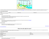
This article provides a basic explanation of how earthquakes can trigger a …
This article provides a basic explanation of how earthquakes can trigger a tsunami. There is a link to animations that show the impact of tsunami waves.
This presentation uses data from several eruptive episodes of Mount St. Helens …
This presentation uses data from several eruptive episodes of Mount St. Helens in the 1980's to show the way in which a series of eruptions were accurately predicted by USGS scientists as far as 3 weeks before eruptive activity occurred. Several modules demonstrate the use of earthquakes and deformation of a volcano for predicting eruptions and allow you to predict an actual eruption of Mount St. Helens using data collected by scientists of the USGS Cascades Volcano Observatory.
This short story presents the issues involved in deciding how water will …
This short story presents the issues involved in deciding how water will be used in the development of a new town. A link is also provided on the page to a script adaptation of the story so that students can act out the story through role play.
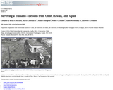
This webpage provides several brief articles that describe the causes and impacts …
This webpage provides several brief articles that describe the causes and impacts of large tsunamis, as well as offering tips related to preparation for and safety during a tsunami.
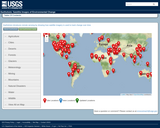
This series of activities supports the interactive map "This Dynamic Planet: A …
This series of activities supports the interactive map "This Dynamic Planet: A World Map of Volcanoes, Earthquakes, and Plate Tectonics" and the complementary booklet "This Dynamic Earth: The Story of Plate Tectonics." These resources engage students in learning more about the interior forces of the Earth and the theory of plate tectonics. Students will investigate the fossil evidence that supports Continental Drift and create a model of the tectonic plates on a spherical surface.
In this activity, students take a water sample from a local waterway …
In this activity, students take a water sample from a local waterway and collect, draw, or take photos of the plants growing nearby, also noting the color of the soil. They will then test the pH of the water sample to investigate the connection between acidity, soil health, and plant growth.
In this activity, students take water samples from a local waterway. They …
In this activity, students take water samples from a local waterway. They will test the pH and then conduct a series of experiments to investigate the chemistry of the water.
In this activity, students take water samples from a local waterway. They …
In this activity, students take water samples from a local waterway. They will test the pH and then place some jars of water in a windowsill that gets direct sunlight and some in a windowsill that gets no sunlight. After several days, students will make observations about living organisms that may be living in the water.
In this lesson, students will conduct a simple experiment to test what …
In this lesson, students will conduct a simple experiment to test what the ph of water may be when certain solids are added to the water and relate this to the effects of acid mine drainage.
No restrictions on your remixing, redistributing, or making derivative works. Give credit to the author, as required.
Your remixing, redistributing, or making derivatives works comes with some restrictions, including how it is shared.
Your redistributing comes with some restrictions. Do not remix or make derivative works.
Most restrictive license type. Prohibits most uses, sharing, and any changes.
Copyrighted materials, available under Fair Use and the TEACH Act for US-based educators, or other custom arrangements. Go to the resource provider to see their individual restrictions.