
This parent guide supports parents in helping their child at home with the 2nd Grade Social Studies content.
- Subject:
- Social Studies
- Material Type:
- Curriculum
- Reference Material
- Vocabulary
- Author:
- Kelly Rawlston
- Letoria Lewis
- Date Added:
- 03/06/2023

This parent guide supports parents in helping their child at home with the 2nd Grade Social Studies content.

This resource accompanies our Rethink 2nd Grade Social Studies Geography unit. It includes ideas for use, ways to support exceptional children, ways to extend learning, digital resources and tools, tips for supporting English Language Learners and students with visual and hearing impairments. There are also ideas for offline learning.
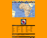
This interactive map of Africa contains links to country maps which provide information such as, population, flag, language, capital, industry, and agriculture.
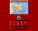
This interactive map of Asia contains links to country maps which provide information such as, population, flag, language, capital, industry, and agriculture.

In this lesson, students demonstrate the ability to use the compass rose to indicate directions, create and use map symbols, create a map of a familiar area, and demonstrate how to use a map legend.
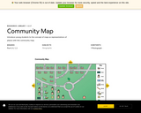
Students explore a map of a community. Students use the map to begin to learn spatial concepts such as identity, location, and symbols.

This second chapter covers the geography standards for second grade. Now that students have a firm understanding of what a community is, we move into the study of communities by getting students into exploring maps. In Kindergarten and First grade we had teachers construct a classroom box. This activity was designed by Dr. Phil Gersmehl and his wife Carol and is based upon some of the work they did in Harlem New York. In this chapter we once again revisit the idea of a classroom in a box, and present to you here instructions for making your own.

This resource allows students to identify the direction of items from their town by placing them on a compass rose.
Students learn about their home state by creating it using Mr. Nussbaum’s Map Builder 2. This site is great for creating just about any land map imaginable!
In this OLogy activity, kids learn how a compass works and why it will always point north. The activity begins with an overview that discusses our reliance on directions and how a compass works. Students are then given step-by-step, illustrated directions for creating a compass with a sewing needle, a small bar magnet, a small piece of foam, and other household items. The activity includes ideas about how to try out your compass.
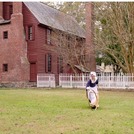
This virtual field trip from Historic Bath State Site is a fun way to learn more about a kid's life in the 18th century. The field trip packet contains ,links to YouTube videos of costumed interpreters demonstrating historic activities, pre- and post-watch content for educators that provide context and engagement, and follow-up activities (games, crafts, and coloring pages). Live Q&A can be booked as part of the field trip as well.

Students identify a globe as a model of the Earth. They interact with maps and globes to locate land masses (continents) and oceans.

In this lesson, students identify a globe as a model of the Earth. They interact with maps and globes to locate land masses (continents) and oceans.

This lesson will address the physical and human characteristics of the local community. Students will build geographic vocabulary as well as use map skills.
With this resource, students learn how to use a compass rose to respond to questions about directions.
In this lesson, students learn that picture symbols can be used to express ideas.
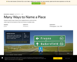
Students analyze maps of places from neighborhood to world and then create maps for the locations of their own homes at multiple scales.
In this lesson, students learn the definition of a map legend, identify the symbols for cities, and locate specific cities on a United States map.

In this lesson, students learn the definition of a map legend, identify the symbols for cities, and locate specific cities on a United States map.
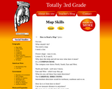
This resource contains lyrics to How to Read a Map to help students understand how to read a map. Click on the Listen button to hear the melody of the song.