An engaging lesson using Dash robot to help students identify and describe different attributes of landforms.
- Subject:
- Applied Science
- Computer Science
- Social Studies
- Material Type:
- Activity/Lab
- Date Added:
- 03/17/2023

An engaging lesson using Dash robot to help students identify and describe different attributes of landforms.

This parent guide supports parents in helping their child at home with the 1st Grade Social Studies content. Within the folder you will access Parent Guide PDFs in FIVE Languages: Arabic, English, Hindi, Spanish, and Vietnamese to help on-going communication with caregivers.

This resource accompanies our Rethink 1st Grade Social Studies Geography unit. It includes ideas for use, ways to support exceptional children, ways to extend learning, digital resources and tools, tips for supporting English Language Learners and students with visual and hearing impairments. There are also ideas for offline learning.
In this lesson, students use maps to explore the US and/or their local region. Then they will draw their state, its neighbors and indicate notable landforms as if they were viewing them from the window of an airplane.
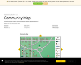
Students explore a map of a community. Students use the map to begin to learn spatial concepts such as identity, location, and symbols.
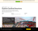
Students learn to identify cardinal directions using their own classroom, other locations in and near school, and maps and globes. Then they discuss differences in temperature due to location.

Students identify a globe as a model of the Earth. They interact with maps and globes to locate land masses (continents) and oceans.

In this lesson, students identify a globe as a model of the Earth. They interact with maps and globes to locate land masses (continents) and oceans.

This lesson will address the physical and human characteristics of the local community. Students will build geographic vocabulary as well as use map skills.
This Blended Learning Unit is designed to intentionally integrate technology into each lesson while maintaining the integrity of a Social Studies unit created by Oakland Schools, Unit 3: How Do We Learn About Places. The 30-45 minute lessons are structured so the classroom teacher can balance whole group instruction (Face to Face) with technology (Online) to enhance or provide new learning. Academic Vocabulary is a school initiative in the district this unit was created for, so this is also integrated throughout the unit. This blended unit was designed for students to use individual iPads, but other devices could be used as well.
Students navigate a map of a local mall, find the places there that are most important to them, and discuss what places are important to other people.

In this lesson, students learn about the people in the school community, their jobs and job descriptions, and identify locations of those jobs within the school. Students also learn how these jobs contribute to meeting the needs of the school community.
Do you think you can make a map of your classroom? It’s easy with The Cat in The Hat This and That map making tool

The object of this lesson is for students to define and explain maps. Students also construct their own maps and develop map skills and appreciate the value of hard work in constructing their own maps.

In this lesson, students will correctly map the locations of landmarks found around their school, correctly identify physical and man made features on a map, and locate a compass rose on a map and/or globe.

Students select an map an area. Then they practice finding direction, determining scale, and identifying natural and human features.

This kindergarten inquiry leads students through an investigation of maps and globes as tools that represent the physical world in different ways. In the inquiry, students consider how each tool represents locations, what purposes each tool serves, and what advantages and disadvantages each tool offers.
In this lesson, students local maps and take walks around the school neighborhood. Students will sketch their own map and then create a 3-D map of the area.
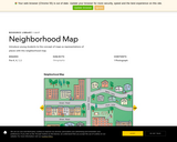
Students explore a map of a neighborhood. Students use the map to begin to learn spatial concepts such as identity, location, and symbols.

Students can design and create their own maps using resources from the Smithsonian Museums.